Whether you’re hiking in the backwoods, sailing out to sea, or simply enjoying an outdoor sporting event, it’s extremely beneficial to be able to predict the weather. Of course, predicting it several days in advance has become a multi-billion-dollar industry, and skilled meteorologists can make big bucks forecasting the week’s weather with high-tech satellites and radar. It’s nice to have an idea what to expect in the next few days, but what really matters to a survivalist is the next few hours. Being caught unaware by a rapidly-approaching storm can result in hypothermia and may even put your life in danger.
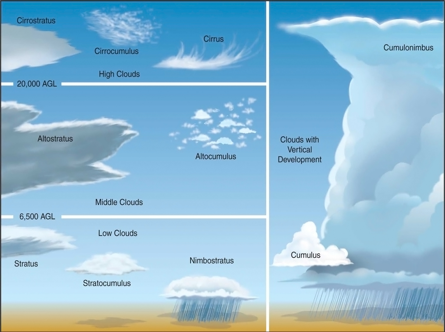
Fortunately, you don’t need access to the Doppler 9,000 to identify incoming weather patterns in your immediate vicinity. You can use a method that has been practiced since the dawn of time: reading the clouds. See the infographics below from NOAA and NASA, for a photographic guide to cloud identification. (You can click the image and use the “Download” button in the top right corner for a larger version.)
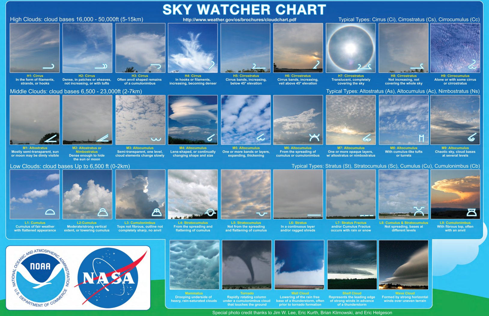
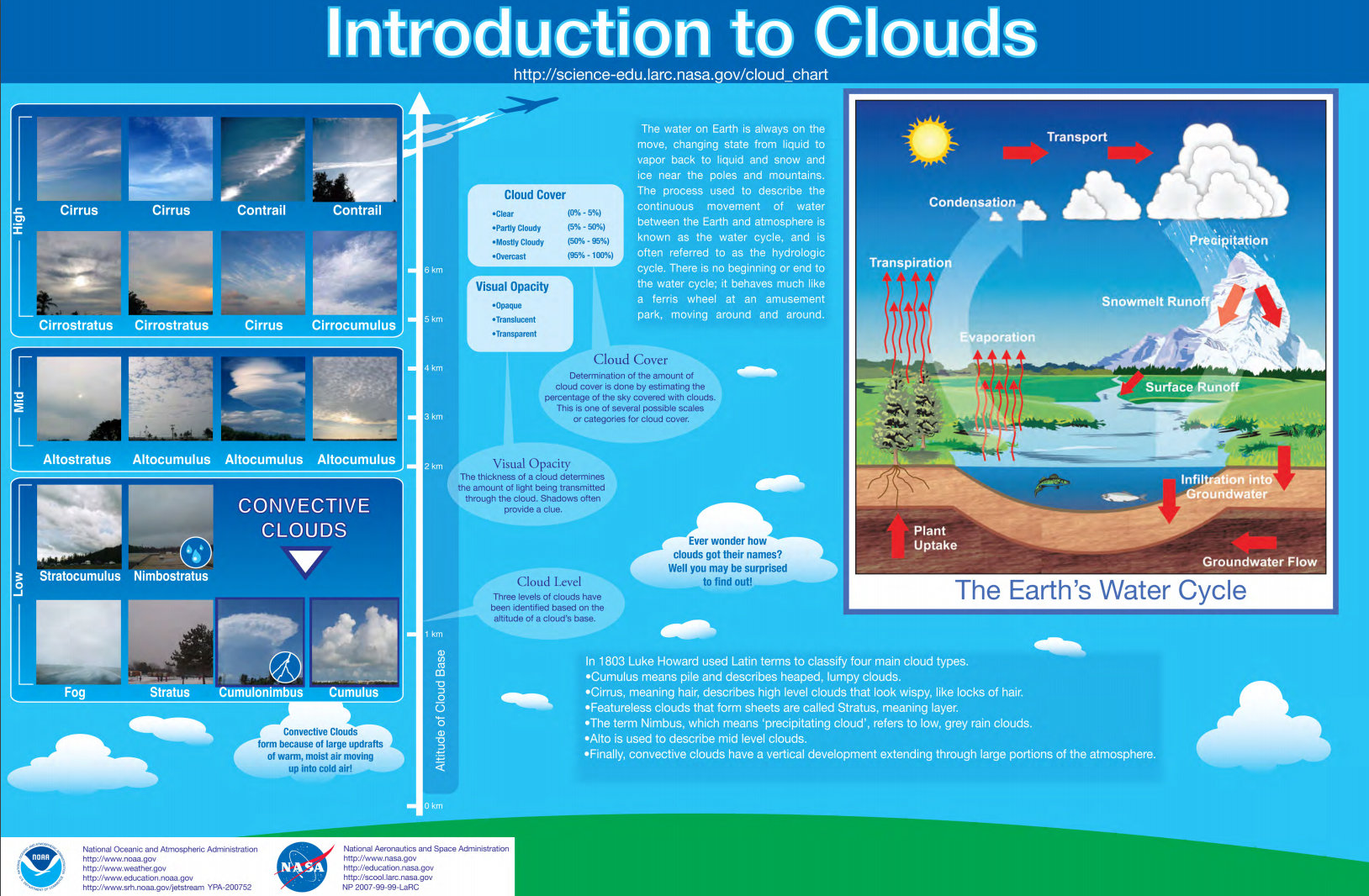
Obviously, there’s a lot of complexity to cloud formation, and this subject can be confusing at first. As a general rule, clouds grow larger and sink lower as they build moisture, so watch how high-level clouds in your area develop over time. Most of us have seen the anvil-shaped Cumulonimbus clouds that lead to thunderstorms, so those are an easy type to watch for.
This Youtube video also does a good job explaining the concept of cloud identification and how it relates to weather:
So, to summarize:
- Both cold fronts and warm fronts can bring rainfall, but cold fronts are generally more severe.
- Cold front storm development: wispy high-level Cirrus clouds, rippled high-level Cirrocumulus clouds, mid-level Altocumulus clouds, low level puffy Cumulus clouds, building into larger Nimbocumulus clouds (occasionally anvil-shaped).
- Warm front storm development: wispy high-level Cirrus clouds, high-level layered Cirrostratus clouds, high-level hazy Altostratus clouds, sheet-like lower Stratus clouds, darker Nimbostratus clouds.
