RECOIL OFFGRID Survival Backcountry Cell Phone Land Navigation
In This Article
Some survivalists like to throw shade on using modern technology when survival techniques are involved. You’ll never find a power outlet in the woods! Your satellites can’t triangulate your position when they just got smoked by an EMP-filled nuke, they say.
Absolute doomsday scenarios aside, there are lots of times when technology can be used to get you out of a terrible situation. Or in the case of using your cell phone to navigate, maybe keep you from ever getting into a terrible situation in the first place.

There are a few obvious challenges to using your phone in a place without free Wi-Fi, wakeup calls, or complimentary continental breakfasts. These would include powering your phone, accessing maps of your area, and actually pinpointing and tracking your location. We’ll address some of these concerns here.

Rule #1 for using your cell phone as an off-the-grid land navigation device is to make sure that it’s in Airplane Mode as much as possible. This will help prevent unnecessary apps from running in the background, and stop your phone from pointlessly draining your battery by searching for a data connection that's unavailable in the backcountry.
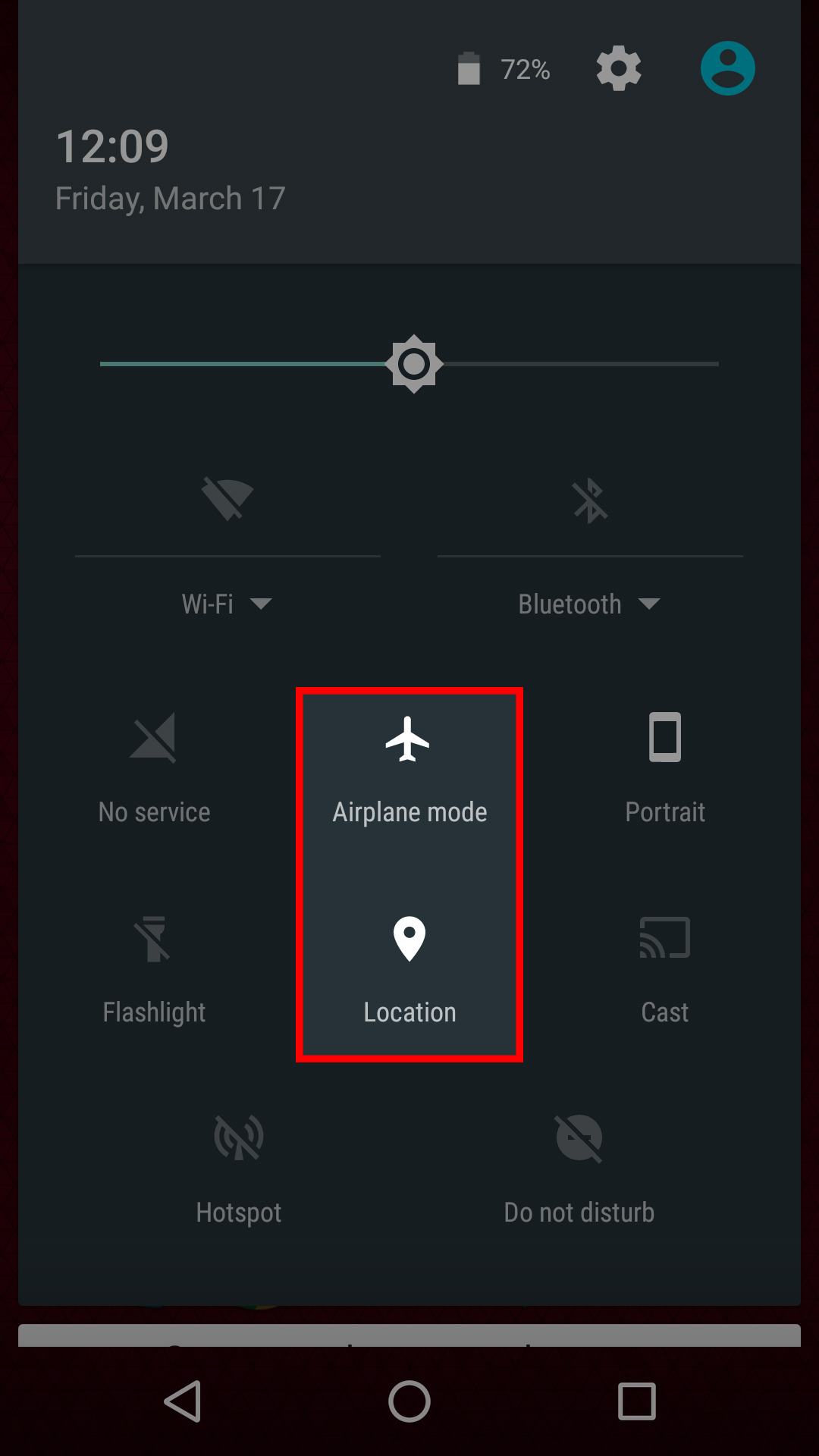
This screenshot shows how to activate airplane mode without disabling location on Android.
You may be thinking, “How can I access maps if I don't have a data connection?” The trick is to download maps to your phone ahead of time so you can pinpoint where you are, even when there's no signal.
This doesn’t mean download the map at the trailhead or after the apocalypse hits, because you probably won’t have service at that point anyway. It means to download the maps of the area you leave before your trip, or at least before you get off the main highway. The doomsday version of this tip would be to download maps of your intended bug-out region before mass panic over a random “covfefe” tweet inadvertently leads to thermonuclear war.
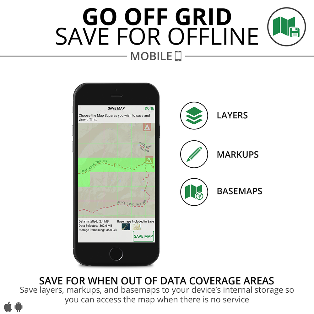
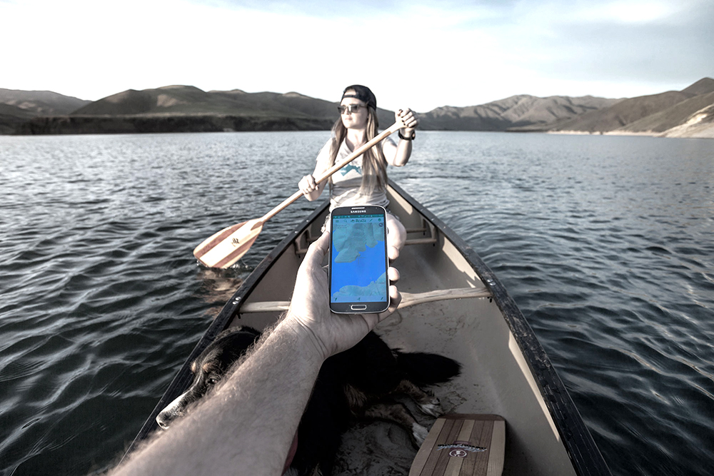
Many mapping services, such as Roam, offer offline map downloads.
The good news is you have a choice of apps for this purpose. Google Maps and its offline download option is arguably the most popular, and it’s free. It allows you to download maps on your phone for offline use, although it’s not really designed for wilderness areas, so it can be hard to locate trails.
The Gmap4 app is also free, and includes automatic conversions to United States National Grid (USNG) coordinates. This would make it simple to convey your location to other people or potential rescuers. It includes access to detailed topo maps, and can even function without the internet, although that trick requires a multi-step workaround that’s easy to do wrong. This is not the most user-friendly mapping system, but it’s free, so even if you decide you hate it you’ll only have lost some time. For someone who likes to tinker and spend some time exploring an app’s hidden functionality, this is not a bad choice.
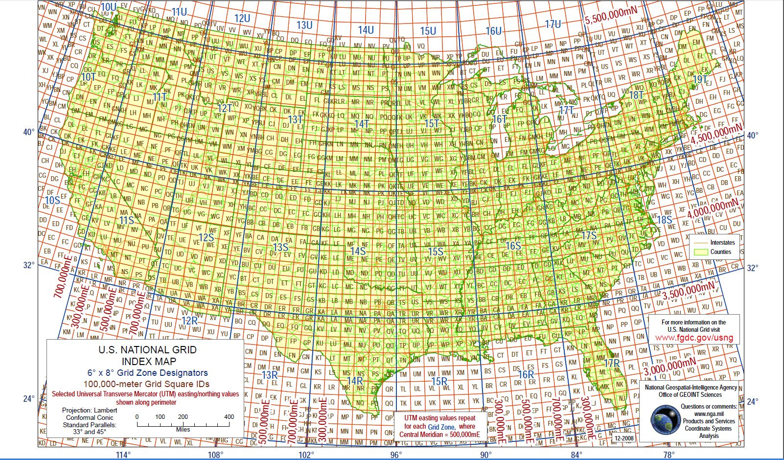
With proper training, your Gmap4 coordinates can be converted to the standard USNG grid format.
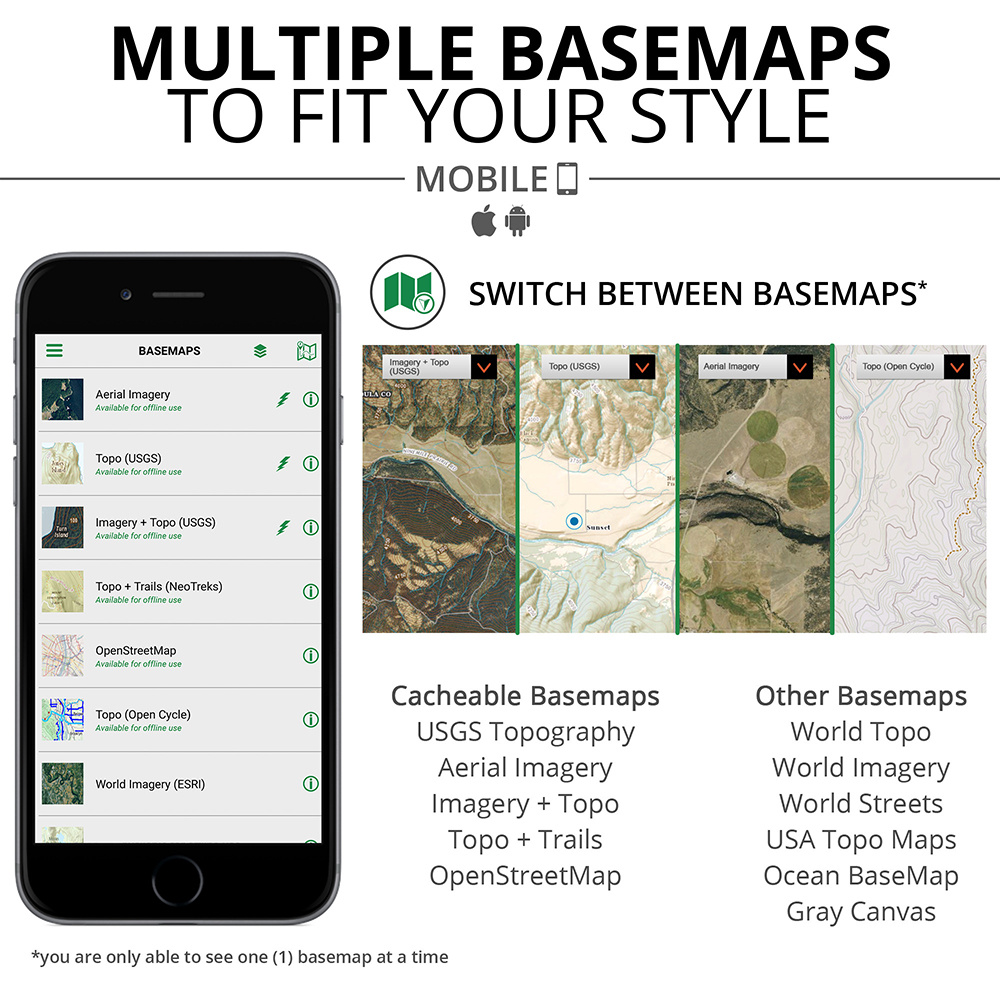
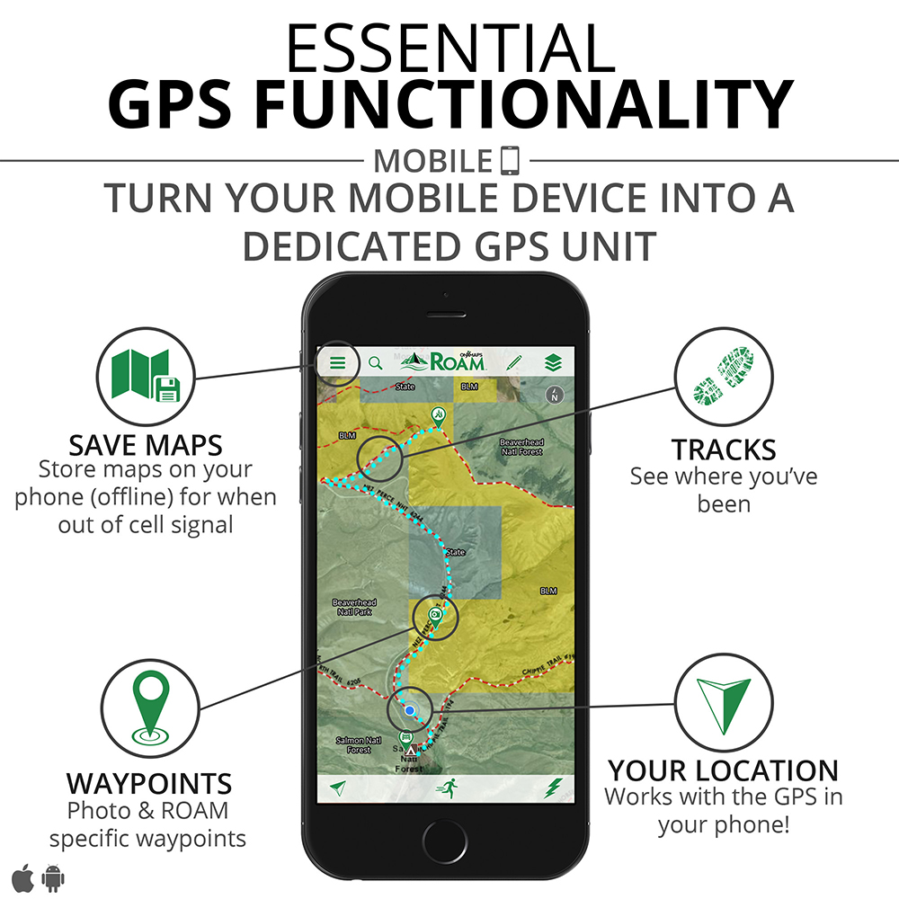
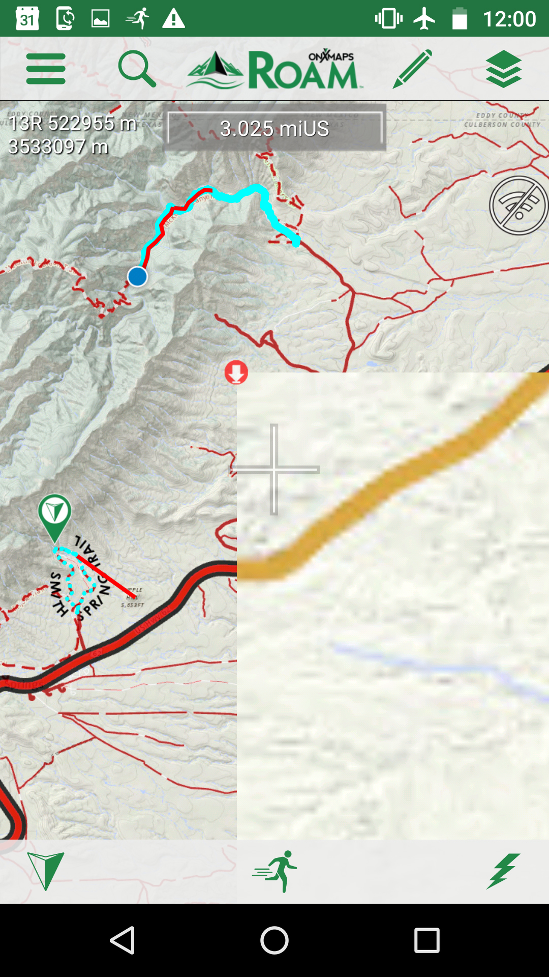
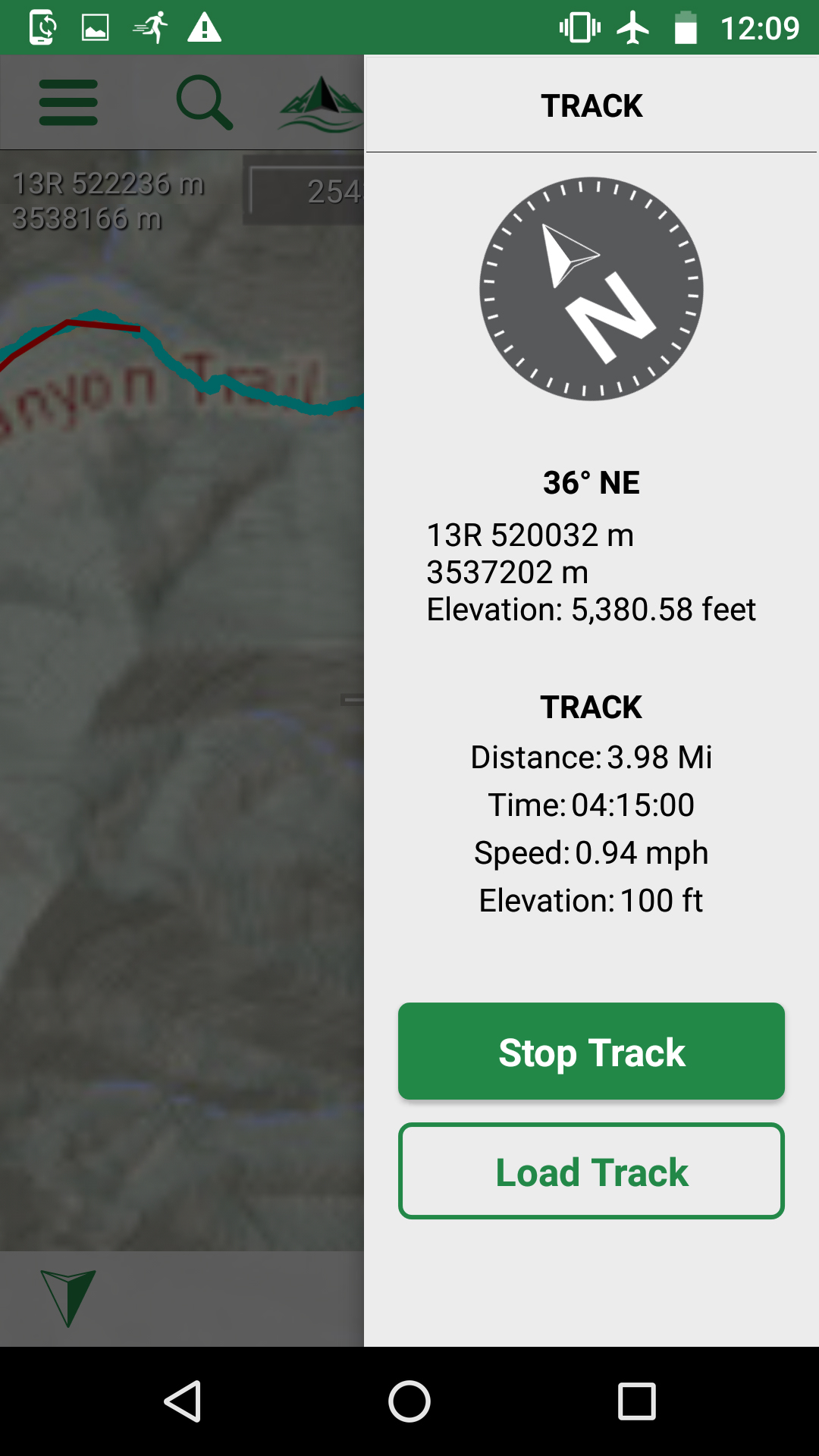
Over the past few months we’ve been using Roam by onXmaps. This modestly-priced app uses a $10-per-year subscription service to seamlessly download location maps (choosing high or low detail), easily record where you’ve been, and draw out a planned path ahead of time which you can follow along during the hike (or drive).
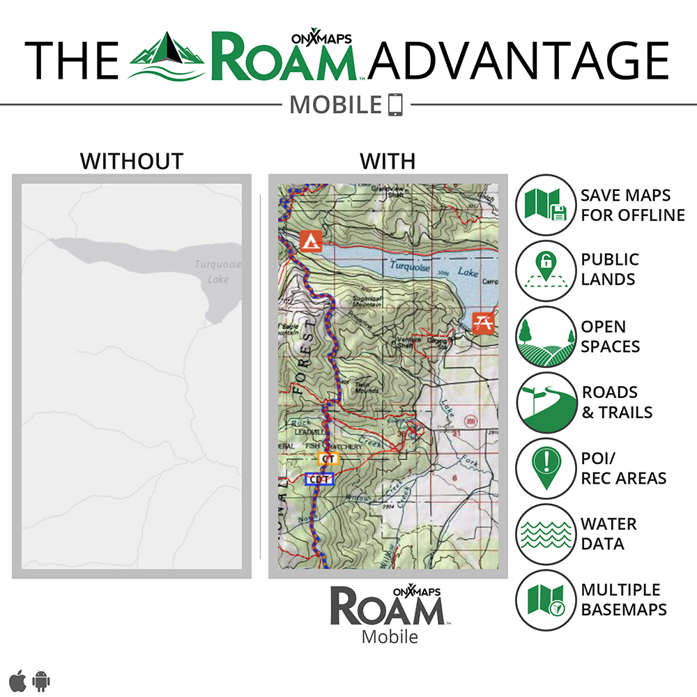
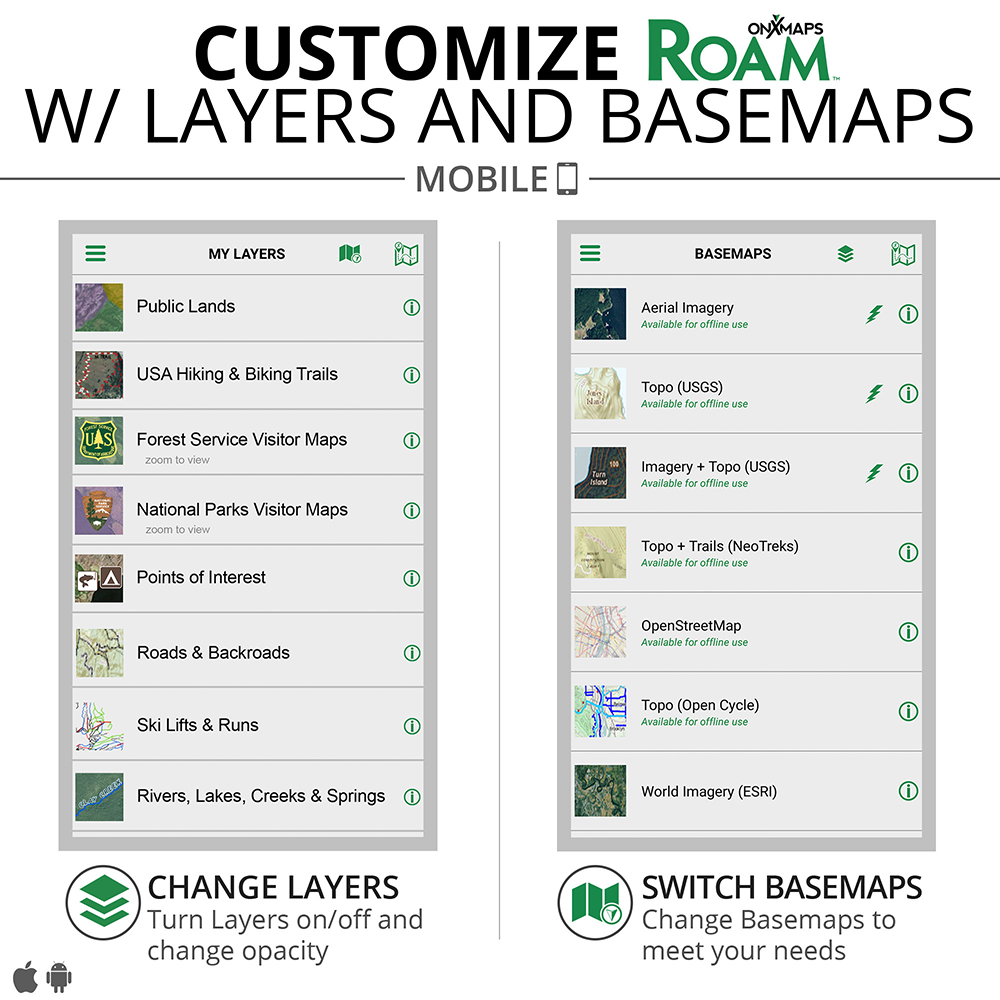
We really liked the Roam app for the variety of maps we could download in advance, including national park maps and specialty topo maps with National Scenic Trails (such as the Florida Trail and the Appalachian Trail) clearly outlined. We were also able to easily compute the distance between where we were and where we wanted to go, by simply drawing a line with our finger on the map.
We used the app on backcountry hikes in Big Bend National Park and Guadalupe Mountains National Park in Texas, as well as Big Cypress National Preserve in Florida. We found that we could download the low-resolution maps for the entire state in order to have a guide for driving, and then with just one more press of a button download high resolution maps for the areas we wanted to hike. Or alternately, if we had an idea of where our base camp would be, we would download that surrounding area in high-resolution ahead of time.
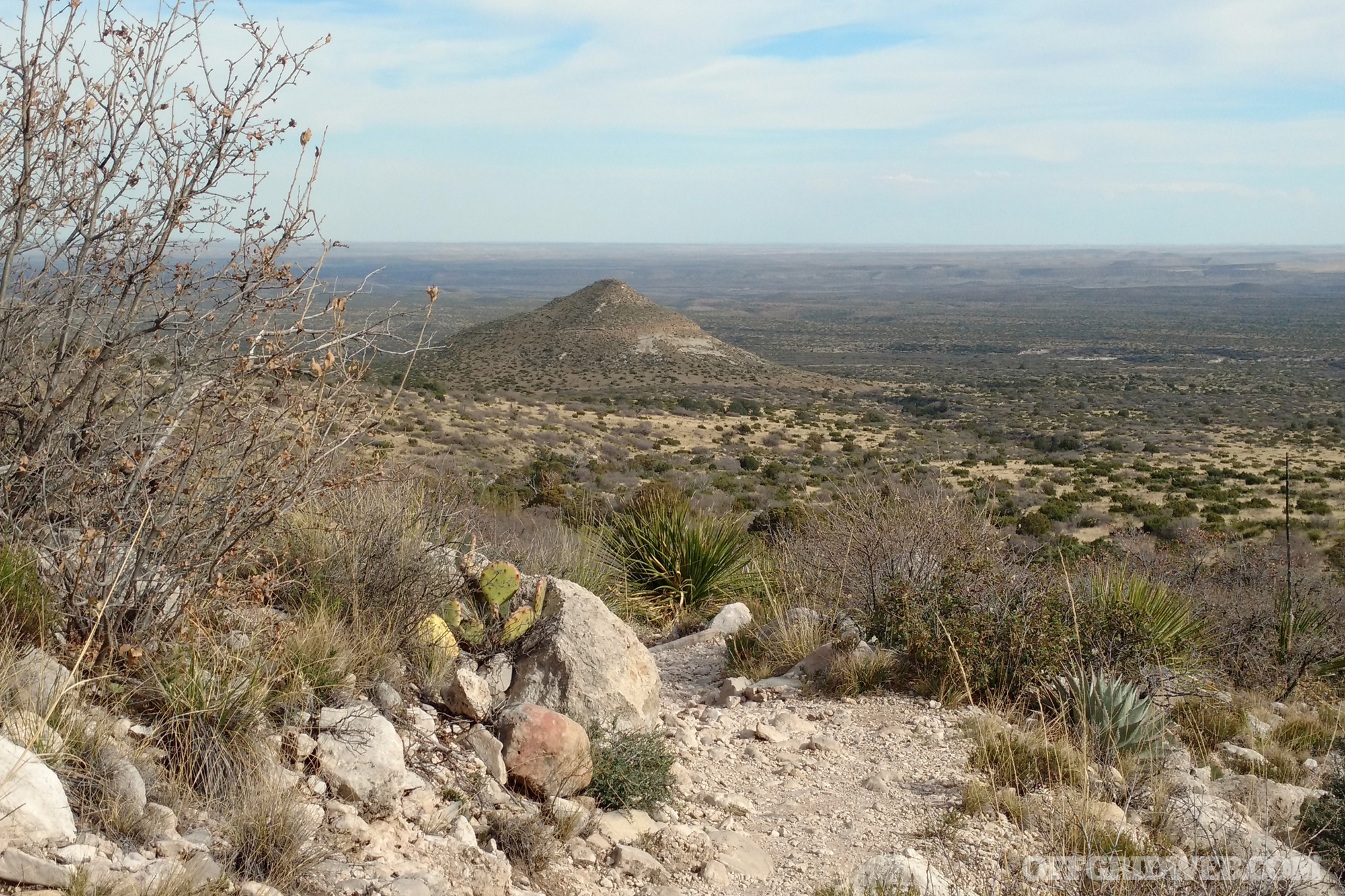
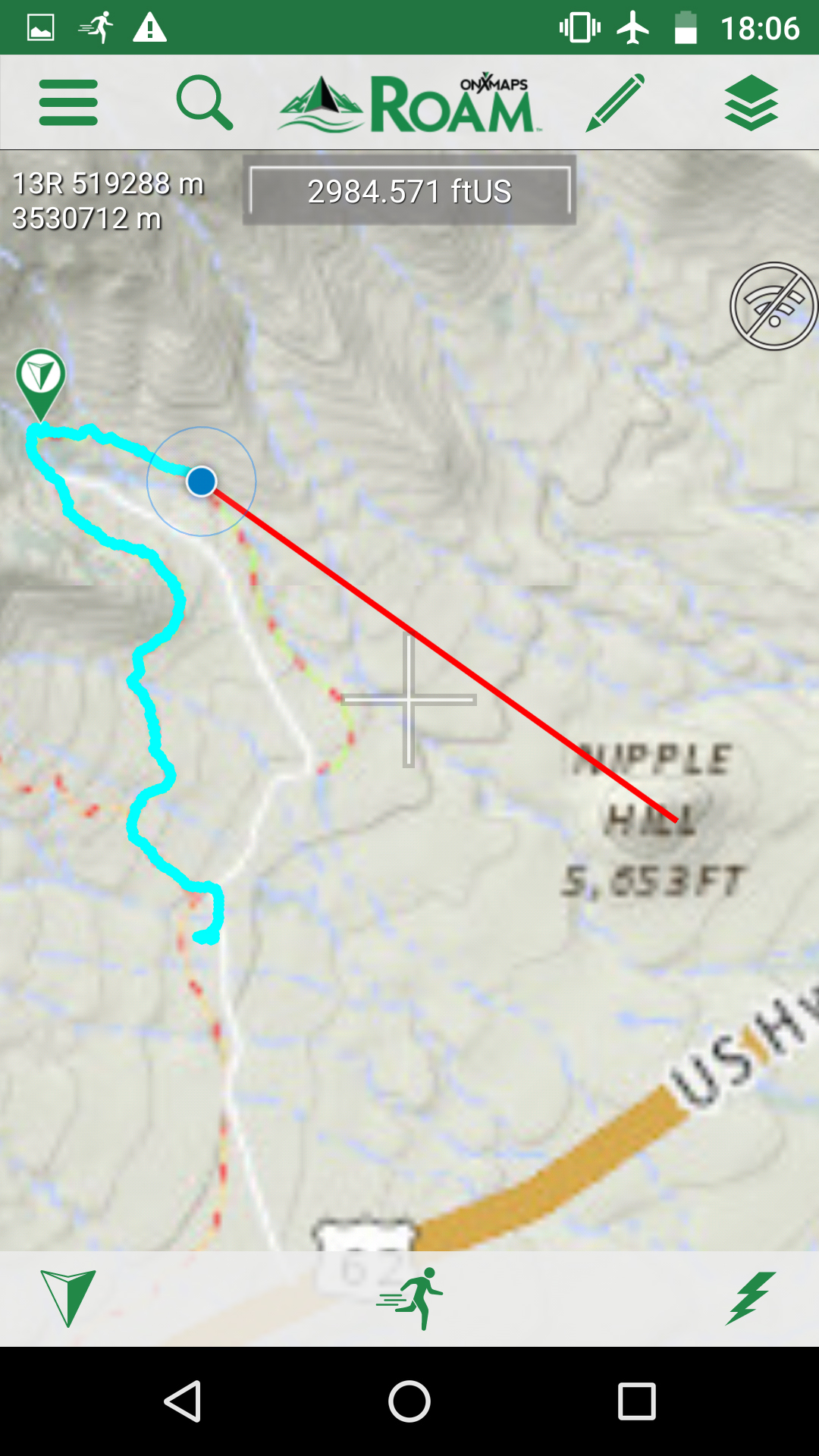
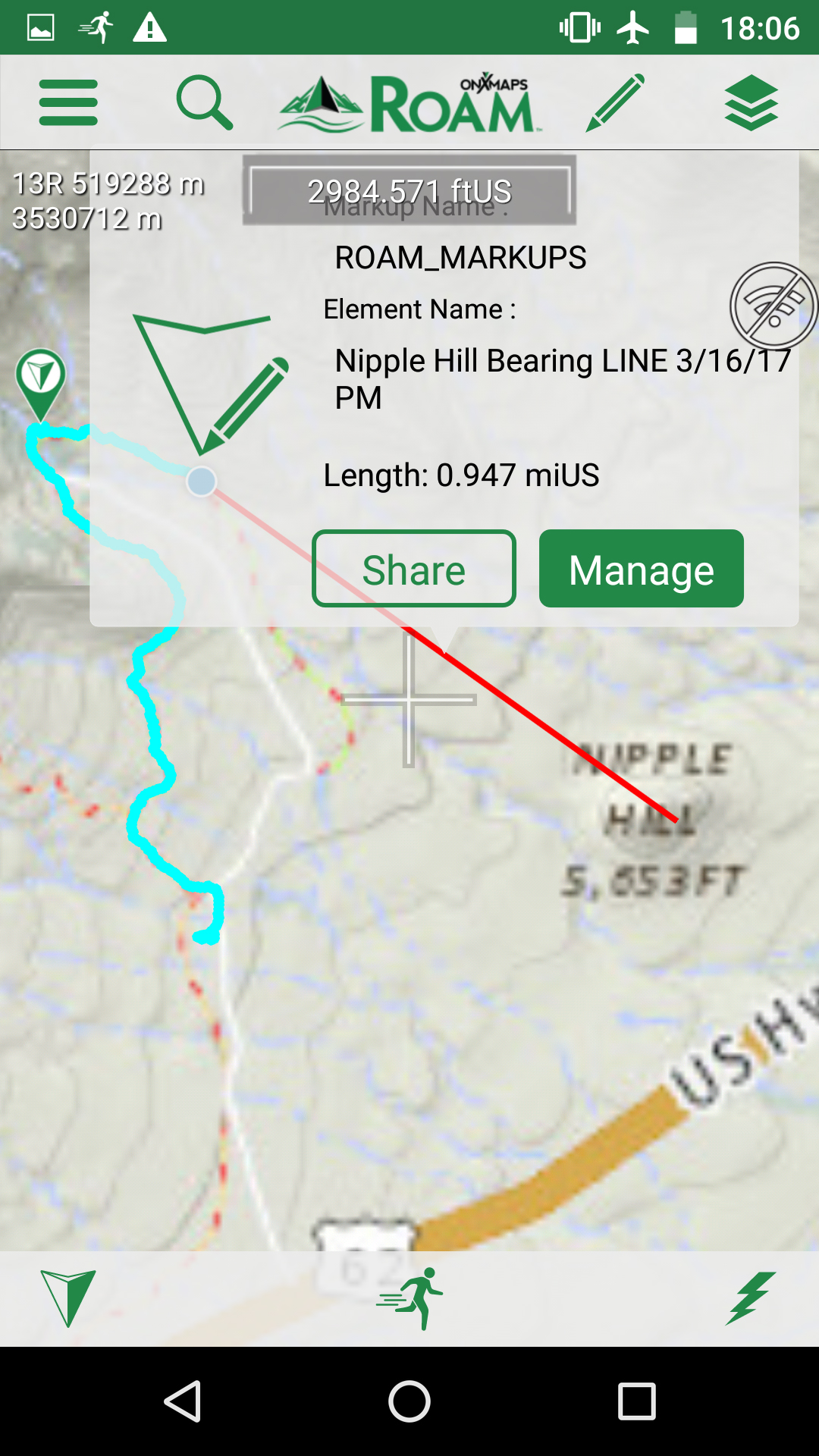
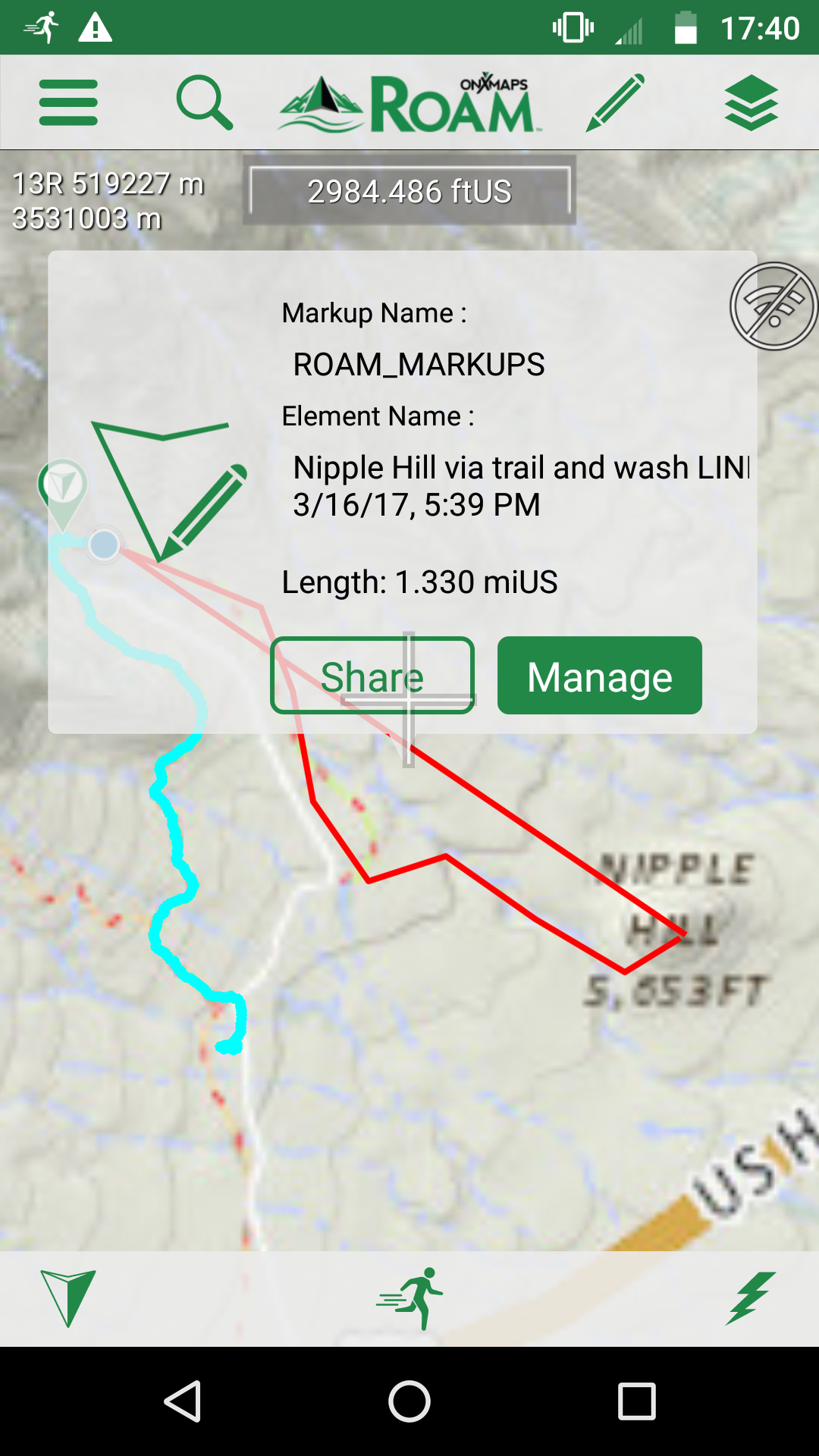
The suggestively-named Nipple Hill in this photo provided a target for plotting our location and course.
Click through the screenshots below to see how we navigated towards the visible landmark aabove and tracked our progress using Roam.
The subscription service is only required to download new maps. So in theory, if you downloaded all the maps you needed and kept your phone in perfect working order you could cancel the subscription. In our case, however, we’re always exploring new locations so the $10 yearly subscription makes sense.
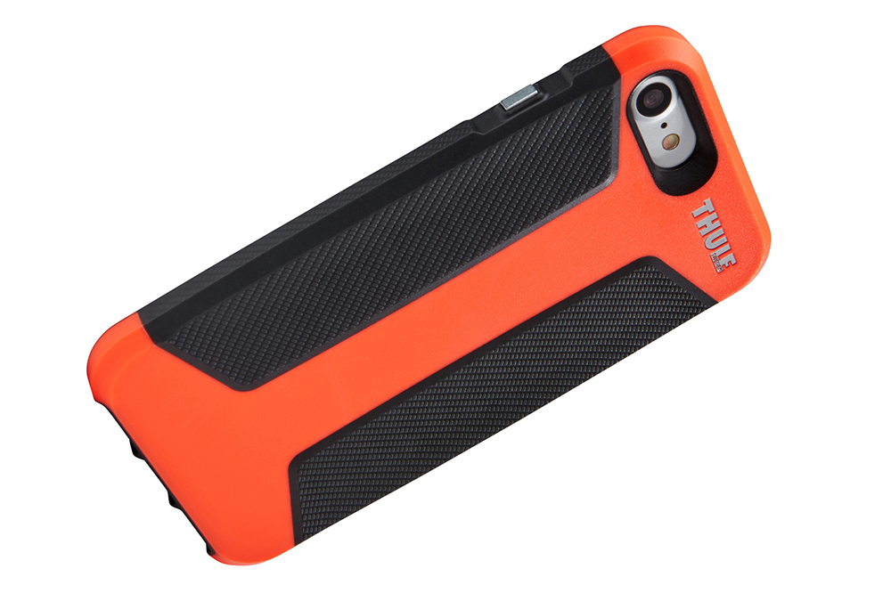
It sounds obvious, but it’s worth mentioning that a durable case will help keep your phone from breaking during use. We use Thule kayak racks on our trucks, so we were glad to find the Thule Atmos X3 cell phone case available for use. The tough polycarbonate case with inlaid rubber grips made us feel much more secure knowing our cell phone navigation device could make it through the backcountry and then back home safely.
If using your phone for navigation, conserving its power should be the foremost thought in your mind. It’s a lot easier to maintain power when you have it as opposed to trying to recharge a dead phone. To accomplish this, there are a couple of things to keep in mind.
Depending on the duration of your backcountry land navigation needs, it may not be possible for the phone to last on just one charge. In this case you can use pre-charged power sources and/or supplement those charging stations using solar power or alkaline batteries.

On our backcountry trips, we first tried out the Moji Charging Station and Lantern from Black Diamond Equipment. This ruggedized device offers up to 250 lumens of illumination and an SOS flashing mode, as well as a thoughtful lockout feature to prevent it from accidentally being turned on during storage or transport. It includes a rechargeable internal battery in addition to AA battery slots, and charges portable electronics using a USB output. So when the internal battery cuts out, you can simply drop in some AA batteries to continue charging your devices.
During testing, we were impressed by how durable and well-made the Moji lantern seemed. This is in part due to its weight—nearly ¾ of a pound without the AA batteries inside, so it’s maybe not the best choice for lightweight backpacking. But of course the weight is in part because there’s a internal battery.
We liked how the lantern held a charge for weeks and months at a time while being stored. Additionally, the lantern is IPX4 rated for water resistance so a little bit of rain won’t hurt it. The only thing we didn’t appreciate was that while charging our phone, the charging function seemed to turn off after 10 minutes or so of charging. When this happened, we’d have to unplug the phone and plug it back in to so the charging function would kick back on. Our phone would eventually charge, although it was inconvenient that we couldn’t just let it sit.
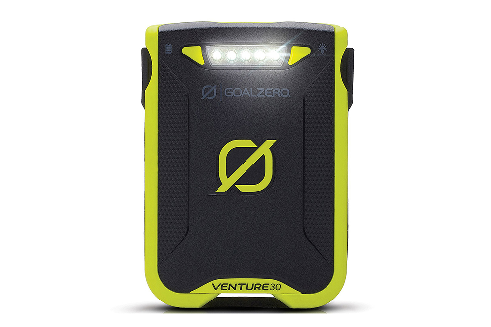
The second system we tried was the Nomad 7 solar charger and Venture 30 charging station and flashlight from Goal Zero. The Venture 30 is a rechargeable portable battery pack similar in some ways to Black Diamond's Moji Charger. It’s more compact and half the weight of the the Moji, although its power capacity and light output isn't directly comparable. The Venture 30 cannot hold AA batteries, although it warrants an excellent water resistance rating of IPX6 which means it can be absolutely blasted with rain, but not submerged.
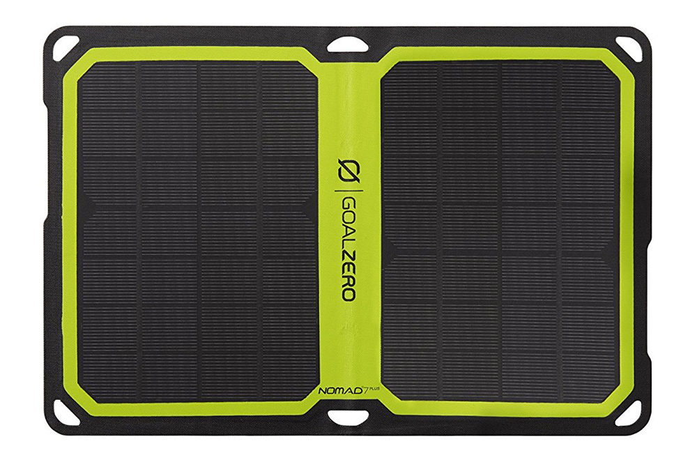
The Nomad 7 solar charger can be paired with the Venture 30, so it can be recharged even if you’re 50 miles away from the nearest wall outlet. During our testing, we noticed that the solar panel only worked in bright sunlight when directly pointed at the sun. So although the concept is fine if you’re going to be stationary in an exposed position, don’t plan on just randomly attaching it to your backpack and thinking it will charge while you’re hiking. At the same time, if you were going to be in a remote camp for months at a time, the solar panels would probably be preferable to packing in 1,000 AA batteries.
All in all, both charging systems were good although both of them required compromises and pre-planning — just like a lot of backcountry hikes we take with our own families.
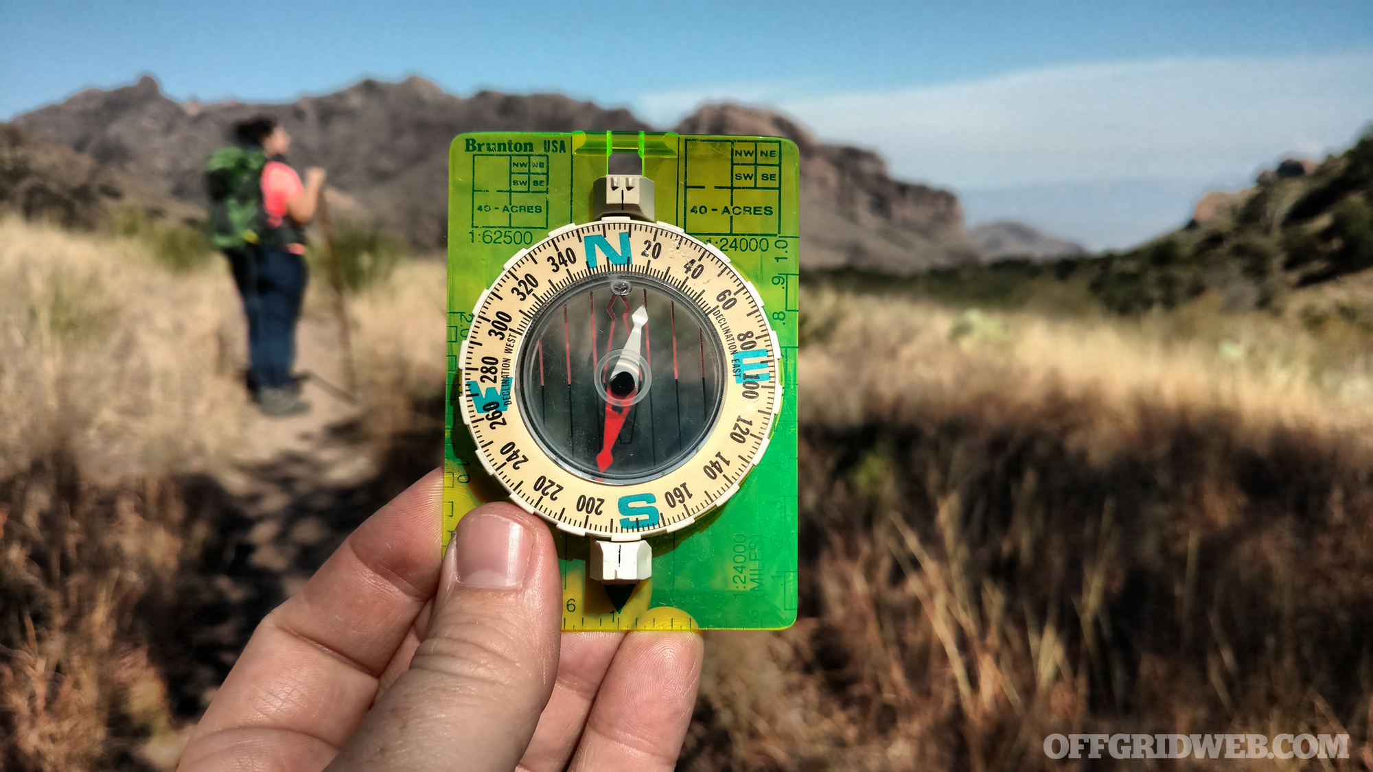
It's always wise to have a backup navigation tool, preferably a good analog compass like this vintage 1960s...
For more information on backcountry land navigation, check out some of our other stories including where to get free USGS topo maps, find a free USNG geo location tool, or gawk at the latest GPS innovations from Garmin.
Andrew Schrader is a licensed professional engineer and is certified by the U.S. Army Corps of Engineers as an Urban Search and Rescue (USAR) Structures Specialist. His company, Recon Response Engineering LLC, advises state and federal government organizations on the subject of urban search and rescue and building collapse. He recently assisted the U.S. Department of State’s Italian Consulate in the development of their post-earthquake response and rescue protocol. You can follow him on Instagram at @reconresponse.
 STAY SAFE: Download a Free copy of the OFFGRID Outbreak Issue
No Comments